
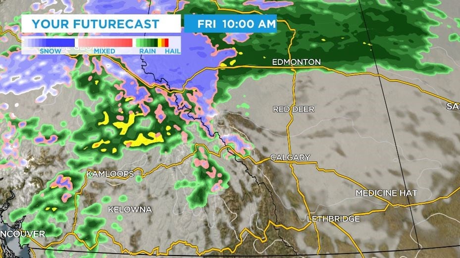
A strong low-pressure system is expected to move into Alberta on Thursday, bringing precipitation and colder air that could affect long weekend travel across much of western Canada. In Calgary, rain may turn to snow from Friday, while reduced visibility and deteriorating road conditions are possible in some areas.
Warm weather is expected to continue through Wednesday and the start of Thursday in central and southern Alberta. A ridge of high pressure over the western part of the country has driven the warmer conditions in recent days. The incoming system is forecast to bring rain that changes to snow over north-central British Columbia and Alberta late Thursday and early Friday morning, including along the Yellowhead Highway, before moving south and east into B.C.’s interior and across southern Alberta and Saskatchewan.
Recent warmth has left surface temperatures higher, so initial precipitation in the Calgary area is expected to melt on contact on most roadways. However, persistent moisture combined with gusty north winds could have a cumulative impact in some places. Higher elevations may be affected earlier and more severely, with visibility likely to fall and roads, pathways and sidewalks potentially becoming slippery or icy as conditions deteriorate.
Calgary’s daytime high on Friday is expected to reach 17 C. Temperatures are forecast to fall to about 2 C by Friday evening as colder air arrives, and are not expected to rebound for at least a few days. Saturday and Sunday highs are forecast to be around 2 to 3 C, with overnight lows below freezing.
From Friday, Calgary is likely to receive at least some mixed precipitation, and probably some snow. Snow accumulations are expected to be on the lower end in the city, though the forecast could change depending on where the low-pressure system tracks by Thursday night. Weekend temperatures will be notably cooler than those of the past week.
Based on reporting by CTV News Calgary.